Create a free profile to get unlimited access to exclusive videos, sweepstakes, and more!
The islands of yesterday and tomorrow

Quick! What's the closest country to the United States that does not share an actual land border?
When I saw this question on the Earth Observatory Image of the Day website, my first thought was Cuba, which is less than 160 km from the Florida Keys. But that's not right … and it's not even close (literally).
The answer is surprising: Russia! And the distance will surprise you more: At their closest, the US and Russia are less than four kilometers apart!
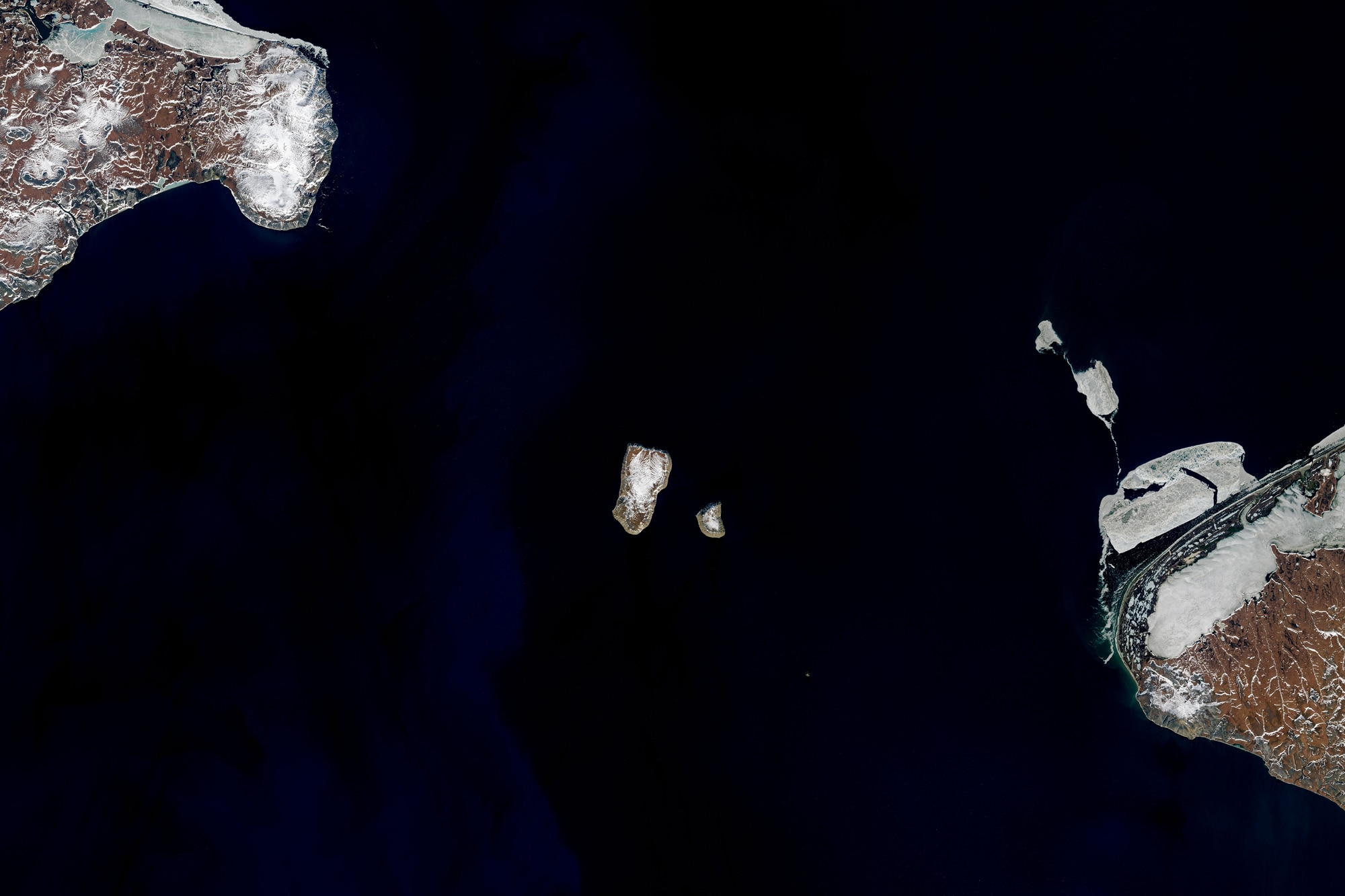
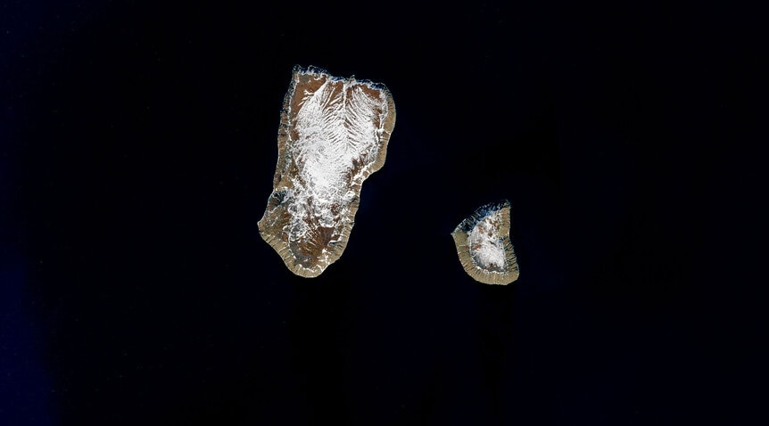
So swing your mind from the warm Florida Keys to the decidedly less temperate Bering Strait, north of the Aleutians. That's the location of two islands sitting side by side: Big Diomede and Little Diomede. Here's a lovely image of them taken by the phenomenal Landsat 8 satellite in June 2017:
Big Diomede is about 8 kilometers long, and Little Diomede just under half that (water absorbs the wavelengths of light used in this image; since no light gets reflected up into space, the water looks black to Landsat 8). Both islands are volcanic, but the origin story of Little Diomede is a little more complicated than that. Both peak about 500 meters above sea level, and it's possible that a land spit connected the two as little as 150 years ago, too.
What makes these islands interesting in this case is that Big Diomede is a Russian property, while Little Diomede is part of the United States! The border between the two countries runs between them, making this the official answer to the question posed above at Earth Observatory.
Big Diomede currently has no permanent inhabitants (it had a military base on it during World War II, and was once populated by Inupiat, but they were forced off during the Cold War by Russia), but Little Diomede has roughly 100 people living on it now. Their proximity means each island is visible from the other.
So hey, if Sarah Palin lived on Little Diomede she really would be able to see Russia from her house!
Another interesting thing is that the International Date Line runs between them. So, if you were standing on Little Diomede and looking to the Big one, you'd be seeing tomorrow, and if you were on Big looking at Little you'd be seeing yesterday! (Well, more or less, since local time zones mean Big is 21 hours ahead of Little, so 7/8 of the time this today/tomorrow thing is true.) So of course they've been nicknamed Tomorrow and Yesterday Islands. Just a quirk of living on a round planet and trying to keep time zones consistent.
I am fascinated by satellite imagery of our Earth, and love learning things like this. It may seem trivial, perhaps, but in fact the history of these islands, both geologic and civil, is pretty interesting. Also, there's just something inherently satisfying in learning something, no matter how small, about where we live. Understanding the Earth makes me appreciate it more, and that fosters love. The beauty of that? Love leads to wanting to understand it more, too.
It's not a vicious circle, it's a virtuous one.


