Mars InSight: Pix from the ground and from space

On November 26, 2018, NASA's latest Mars probe, InSight, touched down on the surface of the red world. Though taking images isn't the key part of the mission — the instruments on board are designed to measure the interior of the planet — shots of the surface and the lander itself started coming back pretty quickly from the two cameras on InSight.
One of those cameras (the Instrument Context Camera) sits below the deck of the lander, giving scientists a wide-angle view of the area around InSight so that they can plan the placement of the main scientific instruments. The other camera is on a robotic arm, and is called the Instrument Deployment Camera (or IDC), which will be used to help give details of the landing site to pick the best spots for the instruments, avoiding large rocks or other hazards.
Because the IDC sits on the arm, it can be used to take images of the lander from different angles. These can then be stitched together to make a selfie, a photo of the lander itself. And that's just what the InSight crew did:

Whoa. So cool! You can see the two parasol-like solar arrays that power the lander, the copper-colored hexagonal cover for the seismograph, the hemispherical wind and thermal shield that will cover the seismograph once the arm places it on the ground sometime in the coming weeks, the tall black cylinder that houses the heat probe, and more (see here for a lovely diagram of all the parts).
What you don't see is the robotic arm itself. That baffles a lot of people; it looks like the images were taken by someone standing on the surface! But in fact each raw image does have the arm in it, but when they are overlapped and stitched together the part of the photo with the arm in it is replaced by part of the next image over that doesn't have the arm in it. The result is this eerie shot that seems to be taken by a nonexistent Martian. Emily Lakdawalla with the Planetary Society has written about how this was done with the Curiosity rover, and the process here is similar (she's also written more about the context of these kinds of shots).
But wait! There's more! Not only do we have a photo of InSight from very close up, but we also have one taken from orbit!
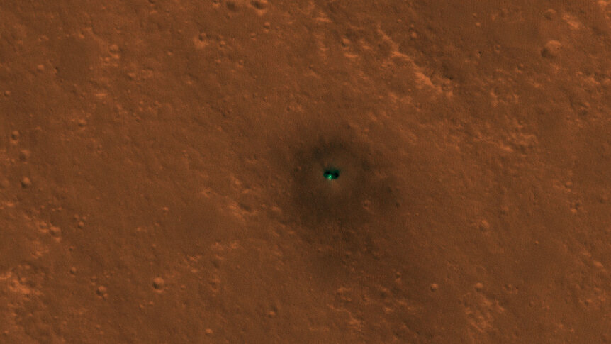
That image was taken using the wonderful HiRISE camera onboard the Mars Reconnaissance Orbiter. Taken from very roughly 300 km above the surface, InSight itself appears small, but some details can be seen; the two solar arrays are visible, and the dust blown out by the landing rockets as it descended leaves a nice pattern around the lander.
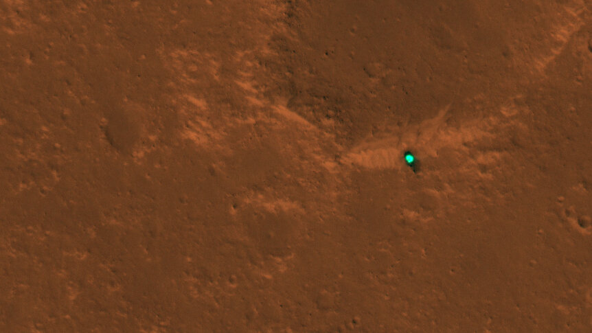
HiRISE also spotted the heat shield (ejected before touchdown once its job protecting the lander from the heat of atmospheric entry was over), which fell a couple of kilometers to the northeast:
It also saw the parachute and backshell (the part attaching the parachute to the lander) a little over a kilometer to the southeast:
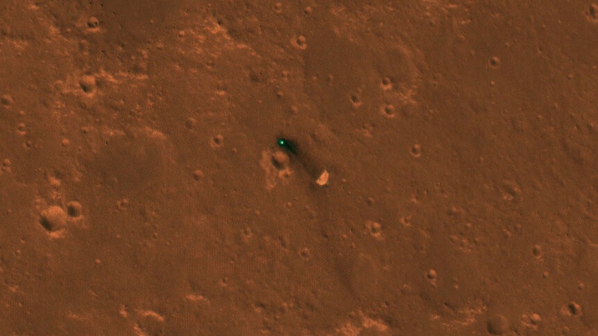
I really like that one; you can see the parachute itself clearly.
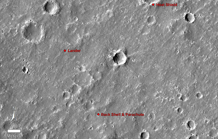
These images aren't just cool (though they are cool). They pinpoint the landing spot, which wasn't known perfectly before. Because the lander was moving rapidly along the ground as it descended, engineers define a "landing ellipse" where they wanted it to set down. It's a statistical thing, where they know it had a very high chance — like 99% — of landing somewhere inside this area. The ellipse was 130 km long and 27 km wide, orientated very nearly east/west. With these new images, the exact location is now known, which will help give context to InSight's landing site as well as help engineers plan future landings.
When it comes to exploring other planets, everything is data. Everything. Even really, really cool images.


")


