Create a free profile to get unlimited access to exclusive videos, sweepstakes, and more!
GOCE Satellite Hours Away from Falling to Earth
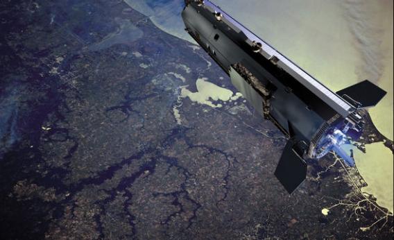
[UPDATE 2 (15:00 UTC Nov. 11, 2013): The ESA is reporting that GOCE fell to Earth, disintegrating at a height of 80 km (50 miles) above the ground, at about 00:16 UTC Nov. 11. It came down near the longitude and latitude of 60° W and 56° S, putting it east of Tierra del Fuego in South America and south of the Falkland Islands â in other words, over water, as expected. Any debris would have fallen into the Atlantic Ocean, and, again as expected, no injuries or impact damage to property has been reported. This ends the saga of GOCE's re-entry. but the data it collected will be useful to scientists for many years to come.]
[UPDATE (02:30 UTC Nov. 11, 2013): ESA has confirmed GOCE has come down, but has not yet said where or when.]
As I write this (22:30 UTC, Sunday, Nov. 10, 2013), the GOCE satellite has at most two hours to live.
The European Space Agency satellite is expected to re-enter Earthâs atmosphere between 22:50 and 00:50 UTC tonight (subtract 5 hours for Eastern U.S. time) â that is, very soon. It is not clear where it will come down. Itâs in a polar orbit â that is, one that moves nearly north-south rather than east-west, bringing it over the poles â and over time, as Earth rotates underneath it, it flies over quite a bit of territory.
Given the predicted re-entry times, it will probably come down in the Pacific or Indian oceans. However, the track does include Australia, Brazil, extreme eastern Asia, and northeast Canada:
This map shows where GOCE will be (in blue) during the predicted re-entry window.
Although many parts of the one-ton satellite will survive re-entry, Iâm not too concerned it will hit anyone; people occupy very little surface area of the Earth, and itâs a big planet. GOCE only spends about ¼ of its orbit over land, and in this case much of it is sparsely occupied (like central Australia and Greenland). Â
GOCE (or Gravity field and steady-state Ocean Circulation Explorer) was designed to map out variations in Earthâs gravitational field, to understand better how gravity affects various things on Earth, such as ocean circulation and sea level. Basically, it was in low-Earth orbit, measuring its exact velocity (which is affected by the local gravity it felt) to determine the direction of âdownâ. Launched in March 2009, it has performed quite well, and the data itâs returned have allowed us to make very sensitive gravity maps of the Earth.
The closer it was to Earth, the better those data were. It was so low that atmospheric drag affected it, even though the air is pretty dang thin at 200 kilometers (125 miles) up. But itâs there, and over time the satelliteâs orbit would lower. It had fuel to compensate, but ran out in October. Its orbit has been dropping since then, and as I write this the satellite is less than 120 km up. The lower it gets, the thicker the air, and the faster it drops. The rate it falls depends on just how thick the air is (which can depends on a great number of factors, including solar activity, which can puff our atmosphere up) and the orientation of the satellite; GOCE is long and sleek, so it drops somewhat slower than a satellite that is broader and presents more surface area âinto the windâ.
This is why itâs not clear exactly when (and therefore where) it will fall. Itâs predicted to break apart due to aerodynamic pressure when it drops to an altitude of 80 km, and then the pieces will fall rapidly to Earth.
Iâll update this post as I learn more.

