Create a free profile to get unlimited access to exclusive videos, sweepstakes, and more!
The Return of the Undulatus Asperatus

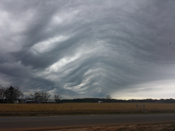
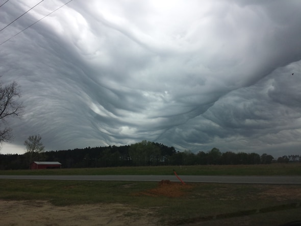
Regular readers know I love interesting clouds, and right now none is more interesting than undulatus asperatus. I’ve written about them before; they’re not yet an officially recognized cloud category, but more of a subset of altocumulus or stratocumulus clouds that form a stable layer. In the right conditions, deep, thick waves develop in the layer that roll across them, producing an eerie and bizarre formation.
Video of them is rare, but a new one popped up by the U.S. National Weather Service when some asperatus clouds blew past near the South Carolina–Georgia border on March 30. Watch this:
Whoa. In the time-lapse animation you can really see the deep waves rolling. Incredible. It’s not entirely clear how they form, but it looks like you need a thick stable layer of clouds, and then a shear wind blowing above them. At the boundary between the two layers a small perturbation can amplify, growing into those huge waves. The Washington Post has more info on that, and some great photos and video, too.
There are lots of great shots of these clouds. Michael McElveen took these shots:
On Twitter, Joel Leopard posted amazing pictures of the clouds from the north Georgia Vogtle Electric Generating Plant:
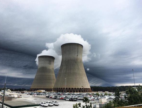
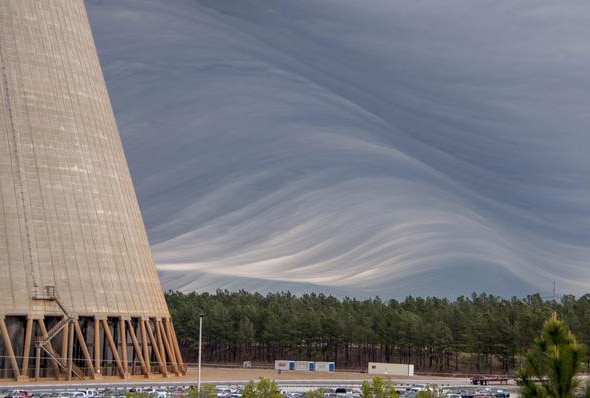
It’s almost like the climactic scene from Raiders of the Lost Ark.
Seeing something like that go by must be seriously freaky. I would love to see that myself. They seem to happen mostly over the southern plains of the U.S., so hopefully I’ll be out there some spring and catch a display. Amazing.


