Create a free profile to get unlimited access to exclusive videos, sweepstakes, and more!
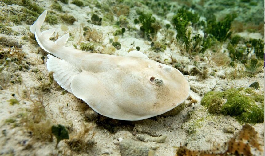
Stingrays and electric rays could be used to map the mysteries of ocean floors

According to the official braintrust at National Geographic, over 80% of our planet's oceans remain unmapped, especially the murky mysteries of the deep seafloors. It's a well-known fact that we have more information on the topography of the Moon and Mars than our own Earth's underwater regions.
To aid in rectifying the data deficit, Japanese researchers are now exploring innovative methods to harness the unlimited resources of Mother Nature, specifically stingrays and electric rays, to help survey the vast seafloors and provide accurate readings for international cartographers and geographers.
Results of their new aquatic study were published last week in the online journal SN Applied Sciences.
A fleet of drone vessels that autonomously scans the seafloor using multi-beam sonars, or aerial platforms bouncing sonar signals off submerged objects might contribute to a greater understanding of what lies beneath, but an armada of rays equipped with ultrasonic hardware could be enlisted to fortify the effort.
"Electric rays and stingrays are benthic animals, meaning that they spend most of their time swimming around the ocean floor in deep places," explains lead study author Yo Tanaka, from the Japanese scientific institute Riken. "By combining simple pinger technology and digital cameras with this natural behavior, we think we can use rays to map the ocean floor, and at the same time collect meaningful data about ocean wildlife, biota, and resources."
According to the paper, this pinger technology is a tiny device that emits ultrasonic sound, which can then be recorded via special receivers. By monitoring the location of the receivers and the time period required for them to detect the bounce-back ultrasonic signal, it allows scientists to hone in on the pinger positions.
This data can then be combined with digital camera footage to piece together a detailed map of a particular sub-surface spot.
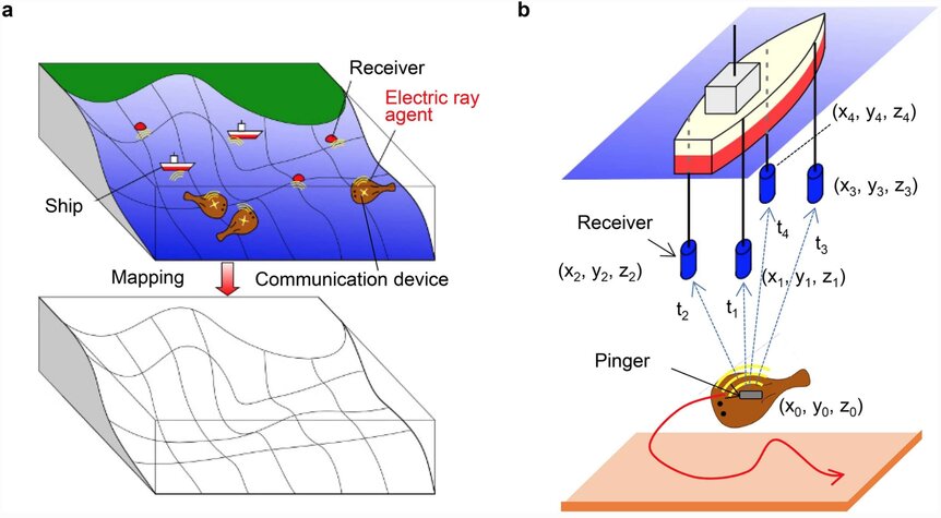
Tanaka and his team initially tested this system by strapping sets of cameras to electric rays and stingrays, then letting them cruise around a huge aquarium tank. Satisfied with the first phase of the project, they then took the subjects to a flat seabed off the coast of Okinawa in waters roughly 60 feet deep.
Both species of rays were sent off to the ocean floor armed with four receivers. During a two-hour session, scientists recorded pinger positions as the rays darted around beneath the waves, letting the crew compose an accurate map of the surrounding seafloor. When compared to a pre-existing map of the same seabed, information collected by the special rays was discovered to be accurate within a four-inch range.
Additionally, Tanaka and his colleagues were able to determine exactly when the rays were zipping quickly through the water or slowly drifting over the seabed, a factor which will be vital in collating consistent mapping data as they dive through the ocean's currents.

"In our ocean experiment, in addition to the pinger positioning, we were able to confirm that electric rays actually move around the seabed," added Tanaka. "In the near future we will test the system for long-term monitoring."
Subsequent experiments will revolve around electric rays using their own electrical juice to power the sensitive ultrasonic pingers, something Tanaka's team indicates it has demonstrated in previous tests. Wearable battery packs will also be deployed for the stingrays, with the sleek creatures assigned to map irregular seabeds over extended deep-sea missions.


