Create a free profile to get unlimited access to exclusive videos, sweepstakes, and more!
The Hidden Earth: Undersea Mountains by the Thousands
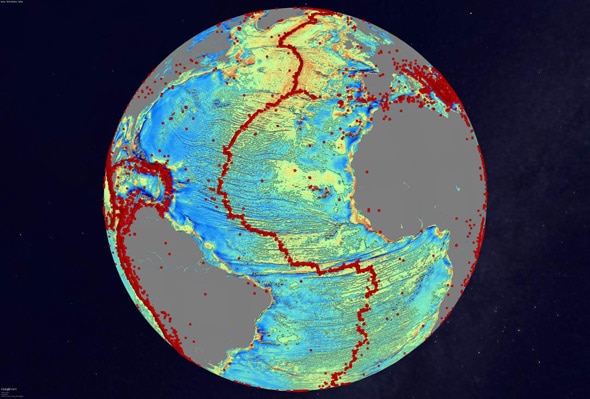
It’s not every day a new mountain is discovered. But then there’s the day you discover thousands of them.
As you might suspect, it’s hard to hide thousand-meter-high mountains anywhere on Earth … unless they’re hidden under thousands of meters of water.
And that’s just where these mountains are: Under the oceans, along the floor, where many modern mapping techniques can’t detect them. We’ve had ships using sonar crisscross the oceans for years, mapping the deep abyss, but as it turns out, oceans are big. There are vast regions the maps don’t cover, and in may places where they do the resolution isn’t detailed enough to spot these seamounts.
Enter satellites. Specifically, Cryosat-2 and JASON-1. Neither was designed to probe the depths of the seas—JASON-1 measures sea level rise, and Cryosat-2 measures the thickness of ice at the poles. But both use sophisticated techniques to map the surface topography (bumps and valleys) beneath them, and that’s what led to the discovery of these mountains.
The key factor: gravity. A mountain under the sea doesn’t have a lot of gravity, but it has some, and it pulls on the water’s surface above it. This can create an extra small bump in the ocean’s surface, which, though small, can be measured by the satellites. It’s incredibly detailed work; scientists analyzing the data have to account for tides, winds, waves, and more. But the satellites passed over the same regions over and again, smoothing out irregularities, leaving behind the signal of the mountains far beneath the waves.
That’s amazing. And the result is spectacular: Literally thousands of mountains, 1,000–2,000 meters high, discovered running across the length and width of the planet. It’s an entire category of our planet that we knew nothing about, and there it is, bang, ripe for the picking. And it doesn’t end there; these new data give more accurate results for seafloor depths, present new evidence for a previously unknown extinct (nonspreading) rift between Africa and South America, and reveal more information about how the Gulf of Mexico formed due to seafloor spreading.
And remember: The satellites weren’t designed to do this! Their data were stored and archived, and scientists went through them to make these astonishing discoveries.
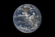
Humanity has lived its entire span right here on Earth, and yet in many ways we know less about it than we do the Moon, or Mars. But as soon as we decided to leave it, to go above it, our knowledge of our home increased by leaps and bounds.
We have much of this planet left to explore … and it’s something we must do. You never know what you might find when you look around.

