Create a free profile to get unlimited access to exclusive videos, sweepstakes, and more!
Scientists Find 25,000 Square Miles of Hidden Coral Reef, Increasing Total by Roughly a Quarter
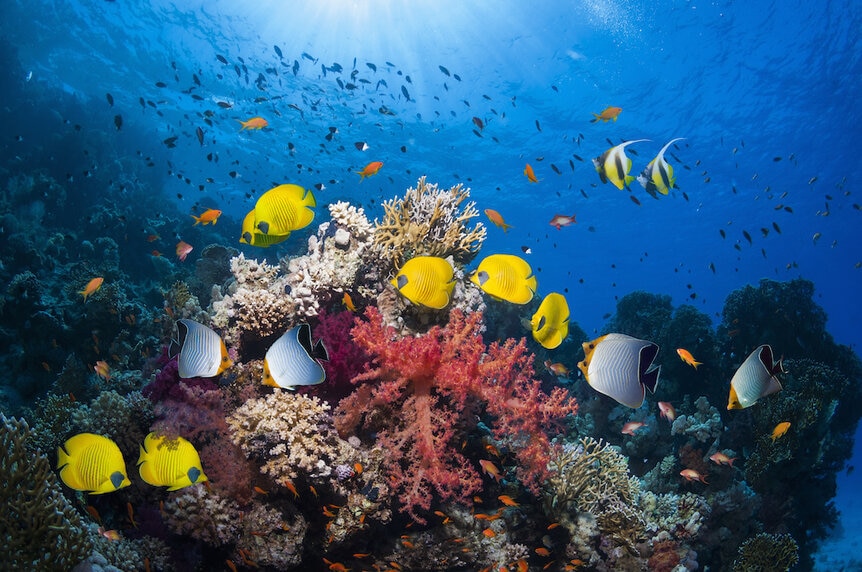
There's more reef than we thought, but corals are still in trouble.

All over the world, hundreds or thousands of years ago, people set sail for parts unknown. They loaded their vessels with supplies and left sight of land, charting their path along the way. They found new islands and new continents and built families on untouched land. Explorers followed coastlines and traced their paths on paper, they ventured into seemingly endless stretches of ocean, and returned with tales of unknown places. Over the course of thousands of years, humanity collectively built a map of the world’s land masses and its oceans. And while it might feel like the age of discovery is long dead, it is very much alive.
Mapping the oceans, both above and below, is a project several millennia in the making, and we haven’t finished yet. We’re unlikely to discover something as Earth-shaking as an ancient war between mermaids and krakens — for that, you’ll have to snag Ruby Gillman Teenage Kraken from Universal Pictures — but there’s still plenty of unknowns to go around. In fact, we’re still learning what ocean ecosystems actually look like and how big they are, before even considering what mysterious creatures those ecosystems are hiding.
A recent survey of the world’s oceans discovered about 25,000 square miles of previously unknown coral reef, according to a study published in Cell Reports Sustainability. The study relied on a combination of satellite data and on-the-water observations, the result of which increased the global reef total by about 25%, when compared to previous estimates.
For More About Coral:
Unearthly, Just Discovered Coral Reef Proves Our Own Planet Can Be an Alien World
Dolphins Visit Coral Spas to Medicate Skin Conditions
Coral Reefs ‘Sing,” and They Change Their Song When They’re Sick
Mapping the World’s Hidden Coral Reefs from Space
When it comes to conservation, there are few tools more valuable than a clear picture of what we’re dealing with. Scientists have known that coral reefs are a lynchpin of marine ecosystems and they have known that reefs are struggling, but they didn’t have a high-quality census of the world’s reefs and how they might be changing globally over time.
For most of human history, mapping anything (reefs included) meant sending someone out to look at it with their own eyes and write down what they saw. Our understanding of global reef systems was an amalgamation of those efforts and necessarily incomplete. In hopes of building a more complete picture, scientists took to the skies with the Sentinel-2 and PlanetScope Dove CubeSat satellites.
Using those satellite instruments, researchers were able to scan the world’s oceans to a depth of 30 meters. From their orbital vantage point, the satellites were able to get a resolution of about 5 meters, meaning that each pixel of the images covered a diameter of 5 meters across the ocean surface.
They took more than 2 million images in total, building a 100-trillion pixel map of the globe. Using the images, the team measured reflectance, water depth, and wave environment of each pixel. Meanwhile, they used 480 datasets from the field, contributed by 400 individuals or groups, to train a machine learning algorithm on how to identify reefs in the satellite images. Finally, the algorithm scoured all of the satellite images to identify reef and not-reef.
To be clear, it’s not as if we’ve suddenly discovered a big chunk of reef we didn’t know about before. Most of the new findings are in familiar places. We already knew there was reef there, we just didn’t quite know the extent of it. Having a clearer picture is great, but the thing about snapshots is they are outdated as soon as you take them. One of the major benefits of this data set is that it’s repeatable and updatable. The original version was released in 2021 and was later revised in 2022, and a significant portion of those updates came from expert user feedback to correct for misclassifications. As long as we have useful satellites in orbit, we can take new pictures to refine our maps and compare them against past data to see if reefs are in decline or recovering. Before we can fix any problem, we have to be able to look it in the face.
We learned that from Ruby Gillman Teenage Kraken, available now from Universal Pictures.


