Create a free profile to get unlimited access to exclusive videos, sweepstakes, and more!
Prehistoric GPS? World's oldest Bronze Age stone map unearthed in Western France

In what might represent Europe's oldest known instance of ancient cartography, a team of researchers working from the French National Institute for Preventive Archaeological Research, Bournemouth University, the CNRS, and the University of Western Brittany has delivered a new study on a 4,000-year-old stone map from the Bronze Age (2150-1600 BCE).
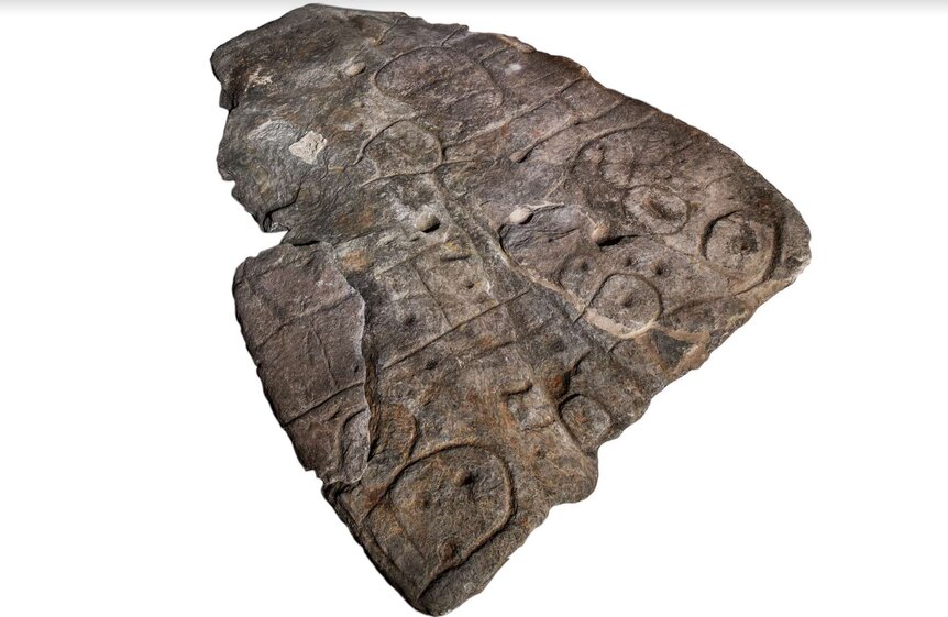
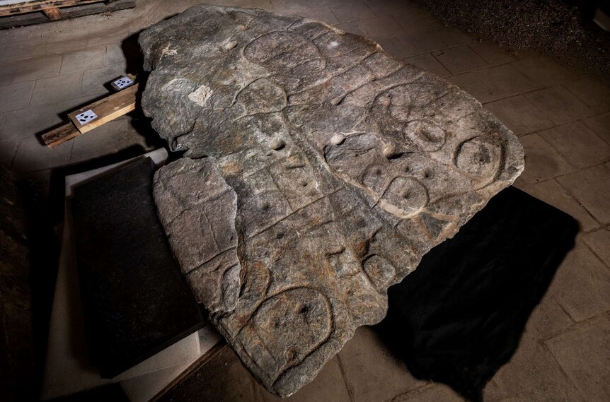
Published in the online journal, Bulletin de la Société préhistorique française, a new analysis of the 5x6 foot relic first excavated back in 1900 by Paul du Chatellier recounts how this remarkable carved slab from Saint-Bélec was recently rediscovered in the cellar of a French castle in Brittany in 2014 after being lost for decades.
Before that, the rare antiquity was apparently laying in a castle moat at Mr. du Chatellier's family estate at the Chateau de Kernuz just 25 miles from where the slab was found.
What's known as the the Saint-Bélec slab was originally unearthed from a Bronze Age grave mound in Finistère, Brittany. It comprised one of the walls of a cist, a type of stone box that housed the bodies of the deceased. The tablet was most likely carved before it was reused in the burrow toward the end of the early Bronze Age, and has now been reexamined and classified as the oldest cartographical representation of a known territory in Europe.
According to the official press release furnished to SYFY WIRE, "The presence of repeated motifs joined by lines gives this composition the appearance of a cartographic layout. The Saint-Bélec Slab does indeed bear the three elements that are most probative of prehistoric cartographic representation: homogenous composition with engravings that are identical in technique and style, repetition of motifs, and a spatial relationship between the motifs (network of lines). To confirm their hypothesis, the researchers compared it with other, similar representations drawn from European prehistory and from ethnography (Tuareg, Papuans, Australian Aborigines, etc.)"
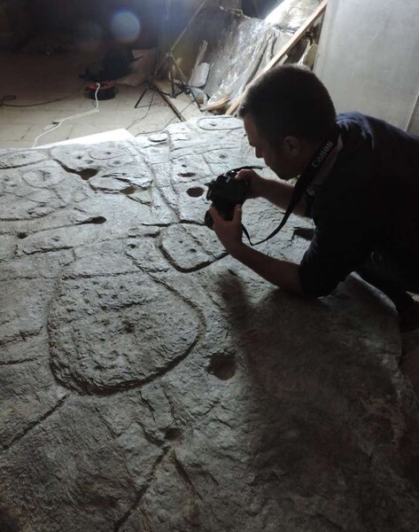
In 2017, a crew of European researchers began analyzing engravings on the famous slab by employing high-resolution 3D surveys and photogrammetry, which is a process of analyzing an object via a series of highly-detailed photographs.
Through this process the team discovered that the giant stone marker contained all the hallmarks of a detailed regional map, specifically representing an 18-mile stretch of territory and valley around the River Odet in Western France.
“There are several such maps carved in stone all over the world," Bournemouth University post-doctoral researcher Dr. Clement Nicolas told the BBC. "Generally, they are just interpretations. But… this is the first time a map has depicted an area on a specific scale… probably a way to affirm the ownership of the territory by a small prince or king at the time. We tend to underestimate the geographical knowledge of past societies. This slab is important as it highlights this cartographical knowledge."


